A tale of two uranium models: EPL 9727 and EPL 8208
July 2, 2026
EPL 8617 is one of those licences that jumps out from the map, covering 10,492 hectares and sitting in a proven uranium district.



Nathan Chutas, PhD, CPG
CEO and Director
Skeleton Coast Uranium Corp.
June 15, 2026
EPL 8617 is one of those licences that jumps out from the map, covering 10,492 hectares and sitting in a proven uranium district:
Of course, this does not prove what is on the ground, but if you’re exploring for uranium, a licence in Namibia’s Erongo Region puts EPL 8617 in one of the world’s most important uranium districts.
And proximity can rhyme with history. EPL 8617 is not a blank page — there is real historical work here.
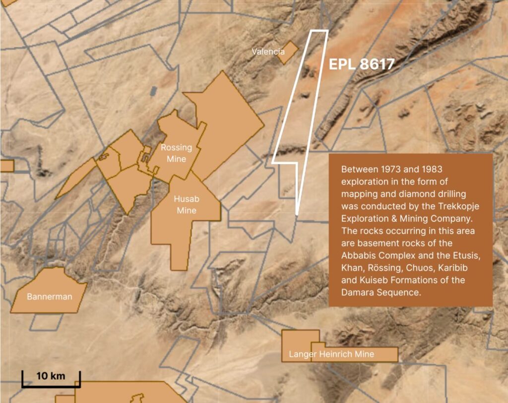
The Valencia radiometric anomaly, referred to as Anomaly 26, was documented on a 1968 Geological Survey airborne radiometric map. Its significance became clearer in 1973 after a more detailed helicopter radiometric survey across the area. Between 1973 and 1983, exploration including mapping and diamond drilling was carried out by Trekkopje Exploration & Mining Company. In other words, this is not ground somebody circled last week because uranium became interesting again.
The historical work tells us earlier operators saw enough in the area to keep working on it. And, for explorers, like ourselves, this matters. The goal is not just to collect hectares. It is to build enough data, context and geological understanding to know which parts of the ground deserve the next dollar and the next drill hole.
But, as a geologist with more than 20 years’ experience, I do not just look at where a licence sits on the map. I look at the rocks themselves. The rocks in the district of EPL 8617 are basement rocks of the Abbabis Complex and the Etusis, Khan, Rössing, Chuos, Karibib and Kuiseb formations of the Damara Sequence — placing EPL 8617 in a geological framework that is already part of the uranium story in this district.
This suggests, all the signals we’re seeing are not just noise.
Historic percussion drilling immediately south and west of EPL 8617 showed paleochannel-type uranium mineralization in a historical, inferred resource estimated to contain about 35 million tonnes at an average grade of 120 g/t U3O8, which is equivalent to about 9.2 million pounds of uranium.
Now, this is where discipline matters.
Those figures are historical, and further drilling and analysis is required before they could be classified as current mineral resources. That distinction matters, and I want to be clear about it.
But this does not mean the historical work has no value, as I wrote in my last post: What historical data tells us, and what it does not. And, what the data is telling us is that EPL 8617 already has the ingredients of a serious exploration target:
This is a much stronger starting point than simply having “prospective ground” with no supporting work to back it up.
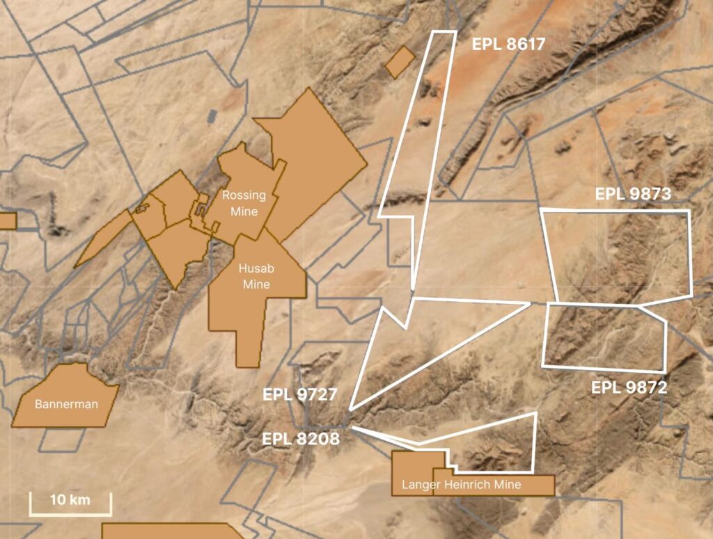
For me, this is why EPL 8617 stands out.
It is not just because it is near Rössing or just because old operators drilled around it — it is because the geology makes sense, the structure makes sense, the location makes sense, and the historical work says this ground deserves a closer look.
Now we’re going to take a look for ourselves.
The historical resource estimates provided here are based on data obtained and prepared by previous operators and have not been verified by either the Company or a qualified person as defined by NI 43-101 and the rules promulgated thereunder regarding the reporting of historical resource estimates. These estimates are considered historical and do not conform to current NI 43-101 standards.